Home » Our solutions » Maritime Security

Maritime Security

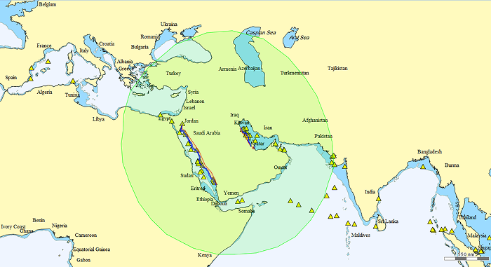
Across the Middle East, growing maritime activity, strategic waterways and offshore energy assets require continuous monitoring and enhanced situational awareness.By combining satellite intelligence, advanced analytics and operational expertise, CLS helps governments, maritime authorities and commercial operators detect threats, monitor activities and protect critical maritime interests.

Discover

From Maritime Awareness to Operational Decision-Making

The Middle East is home to some of the world’s most strategic maritime corridors, energy infrastructure and commercial shipping routes. Ensuring maritime security requires the ability to monitor vessel activity, detect anomalies and rapidly respond to emerging threats across vast areas.

CLS provides a comprehensive suite of maritime intelligence solutions combining satellite data, artificial intelligence and operational expertise to support maritime authorities, coast guards, naval forces, offshore operators and commercial fleets. From maritime domain awareness and pollution monitoring to fleet management and regulatory compliance, CLS transforms complex maritime data into actionable intelligence.

15+ years

of operational maritime surveillance expertise

100M+

vessel positions processed daily

24/7/365

operational data center

Our Solutions for Maritime Security

Oil Spill Services

Fleet Management

Maritime Domain Awareness

Search and Rescue

Maritime Compliance
oil spill modelling

Environmental Intelligence & Pollution Response

Protecting marine ecosystems and coastal assets requires the ability to rapidly detect, assess and monitor pollution events across vast maritime environments.

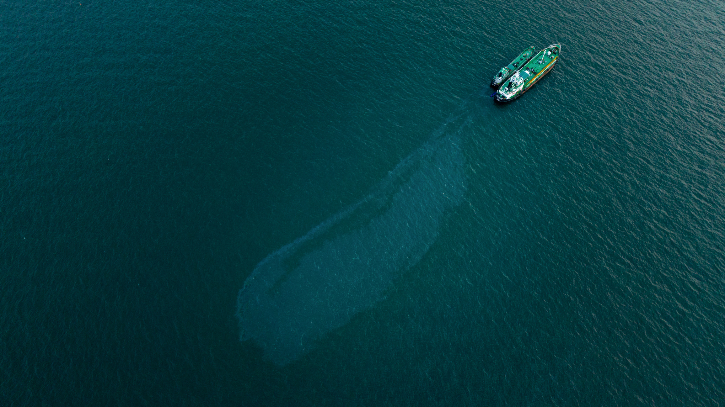
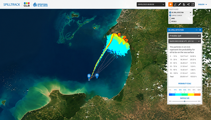
CLS provides advanced oil spill monitoring services combining satellite imagery, environmental data and expert analysis to support early detection and operational response. Leveraging multiple satellite technologies, CLS can identify potential oil spills, track their evolution and assess their potential impact on coastal areas, offshore infrastructure and maritime activities.

By delivering timely and reliable environmental intelligence, CLS supports government agencies, environmental authorities, offshore energy operators and emergency response teams in mitigating environmental risks, improving response coordination and protecting valuable marine resources.

Applications include:

  • Oil spill detection and tracking
  • Environmental monitoring
  • Emergency response support
  • Offshore energy asset protection
  • Coastal impact assessment
rockfleetassured

Fleet Management & Assured Positioning

Maritime operators across the Middle East face growing challenges, including GNSS jamming and spoofing, increasing operational demands and the need for continuous fleet visibility across vast maritime areas.

CLS helps fleet operators maintain trusted vessel positioning, operational awareness and business continuity through integrated fleet management and assured positioning solutions.

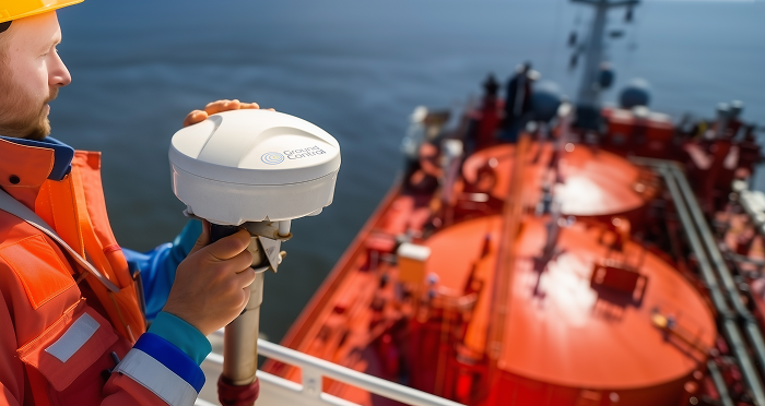
At the heart of this capability is RockFLEET Assured, an innovative navigation resilience solution combining independent satellite positioning, real-time integrity monitoring and GNSS interference detection.

Designed for challenging environments such as the Arabian Gulf and the Red Sea, RockFLEET Assured enables operators to:

  • Maintain trusted vessel positioning
  • Detect jamming and spoofing events in real time
  • Ensure operational continuity in GNSS-denied environments
  • Enhance fleet visibility and navigation safety
  • Integrate trusted positioning data into existing fleet management systems

By combining assured positioning and fleet intelligence, CLS enables maritime operators to improve safety, strengthen operational control and maintain confidence in their navigation data wherever they operate.

maritime-awareseness-system

Maritime Awareness System (MAS)

Operational Maritime Surveillance & Decision Support

The Maritime Awareness System (MAS) provides a comprehensive operational picture of maritime activities by integrating vessel tracking data, satellite intelligence, geospatial information and advanced analytics into a single platform.

Designed to support maritime authorities, coast guards, naval forces and offshore operators, MAS enables continuous monitoring of vessel movements, anomaly detection and threat assessment across large maritime areas. By consolidating multiple data sources into a unified operational environment, MAS helps users rapidly identify suspicious behaviours, monitor sensitive zones and improve situational awareness in support of maritime security missions.

From coastal surveillance and exclusive economic zone (EEZ) monitoring to critical infrastructure protection and incident response, MAS transforms complex maritime data into actionable intelligence for informed decision-making.

themis sar search and rescue patterns

THEMIS SAR

Search and Rescue & Satellite Intelligence

Locating vessels, supporting search and rescue operations and monitoring areas of interest at sea require timely and reliable intelligence, regardless of weather conditions or daylight availability.

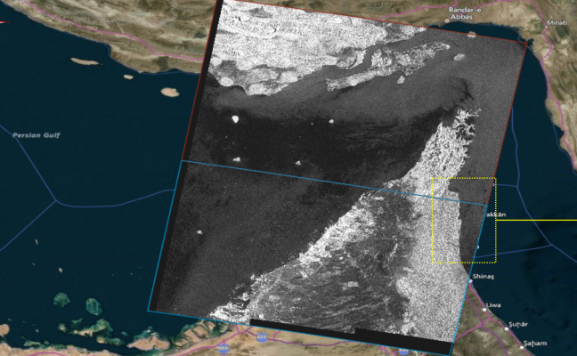
Themis SAR leverages Synthetic Aperture Radar (SAR) satellite imagery and advanced analytics to provide rapid maritime situational awareness over large maritime areas. Operating day and night and through cloud cover, the solution enables the detection and localisation of vessels and maritime objects in support of operational missions where speed and accuracy are critical.

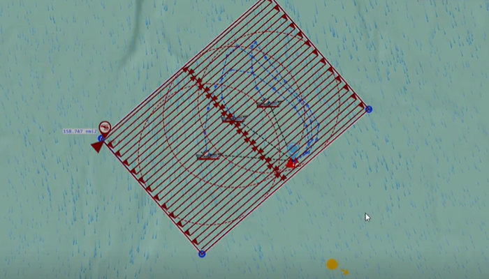
By delivering actionable information to maritime authorities, coast guards and rescue coordination centres, Themis SAR helps narrow search areas, improve operational efficiency and support faster decision-making during maritime incidents. The solution can also contribute to broader maritime surveillance activities by providing additional intelligence in areas where conventional monitoring capabilities may be limited.

Applications include:

  • Search and rescue operations
  • Vessel localisation
  • Maritime incident response
  • Surveillance of remote maritime areas
  • Operational maritime intelligence
LRIT solution - Maritime Compliance

Regulatory Compliance & Vessel Monitoring Solutions

As maritime regulations continue to evolve, authorities and vessel operators need reliable monitoring capabilities to ensure compliance, enhance transparency and support maritime security.

CLS provides trusted compliance solutions that enable continuous visibility of vessel movements and support adherence to international maritime regulations. By delivering secure, globally available tracking services, CLS helps organisations strengthen operational oversight while simplifying regulatory reporting requirements.

CLS is a trusted provider of Long Range Identification and Tracking (LRIT) services, supporting flag states, coastal states and maritime authorities worldwide.

LRIT provides reliable long-range vessel tracking beyond coastal coverage, helping organisations meet international regulatory requirements while enhancing maritime safety, security and fleet visibility.

Applications include:

  • Flag State compliance
  • Long-range vessel monitoring
  • Maritime safety and security
  • Regulatory reporting
  • Search and rescue support